
Architect Minarul
Architectural Plans & Landscape Architecture
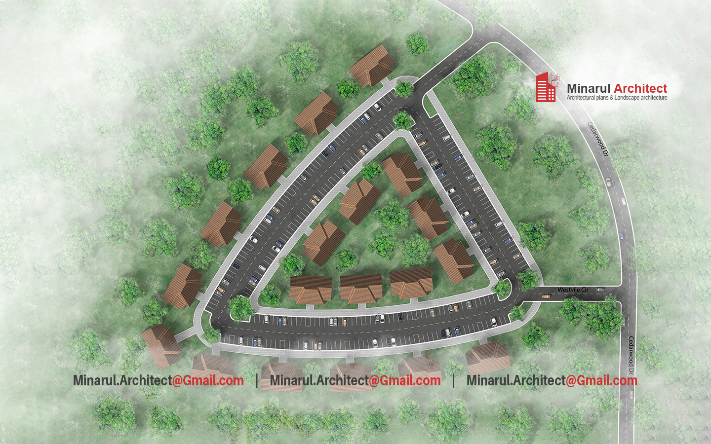
Cluster Housing Site Plan Rendering by Architect Minarul
This image is a cluster housing site plan rendering: multiple residential lots arranged around internal roads, driveways, green buffer zones, and structured layout. It offers a clear view of spatial relationships, cluster form, circulation, and landscape integration.
Below is an in-depth description of what this rendering shows — and how my **cluster housing site plan rendering service** can produce this kind of visual clarity for *your* project.
Why cluster housing site plan rendering is essential
A cluster housing rendering bridges imagination and execution. It helps architects, developers, and clients visualize how homes, green areas, internal roads, and circulation interrelate. With this, you catch design issues early, present a convincing layout, and reduce surprises during execution.
Key elements visible in this sample rendering
- Multiple residential units grouped in clusters around shared roads
- Internal circulation network, driveways, and connecting lanes
- Green buffers, landscaping patches, tree dots, vegetative zones
- Clear lot boundaries, setback limits, and spatial flow
- Context integration: roads that connect to external network, buffer zones to surrounding nature
My process: turning concept into rendered site layout
As **Architect Minarul**, I specialize in **site plan rendering**, **cluster housing layouts**, and **landscape architectural coordination**. Here is my typical workflow:
Phase 1: Site survey & context mapping
I gather boundary data, topography, access points, existing vegetation, and context roads. I map constraints (setbacks, easements, slopes) before sketching.
Phase 2: Conceptual clustering & circulation diagrams
I test permutations: how many lots, internal road layout, green space ratio, orientation. We iterate cluster diagrams until functional and aesthetic logic emerges.
Phase 3: Final rendered site plan illustration
The final deliverable is a high-resolution rendered layout: lot footprints, roads, plants, textures, labels. This version is ready for presentation, stakeholder review, or to guide engineers.
Whether you need **cluster housing site plan rendering**, **residential community layout**, or full **landscape + architectural site coordination**, I’ve got your back. Let’s make your project’s site layout visually convincing and technically sharp.